Cook Inlet OFS
Last cycle 15 Oct 18:00 UTCciofsOperational ROMS nowcast/forecast for Cook Inlet, Alaska, capturing extreme tides, currents, temperature and salinity on a high-resolution curvilinear grid.
Produced by NOAA NOS CO-OPS
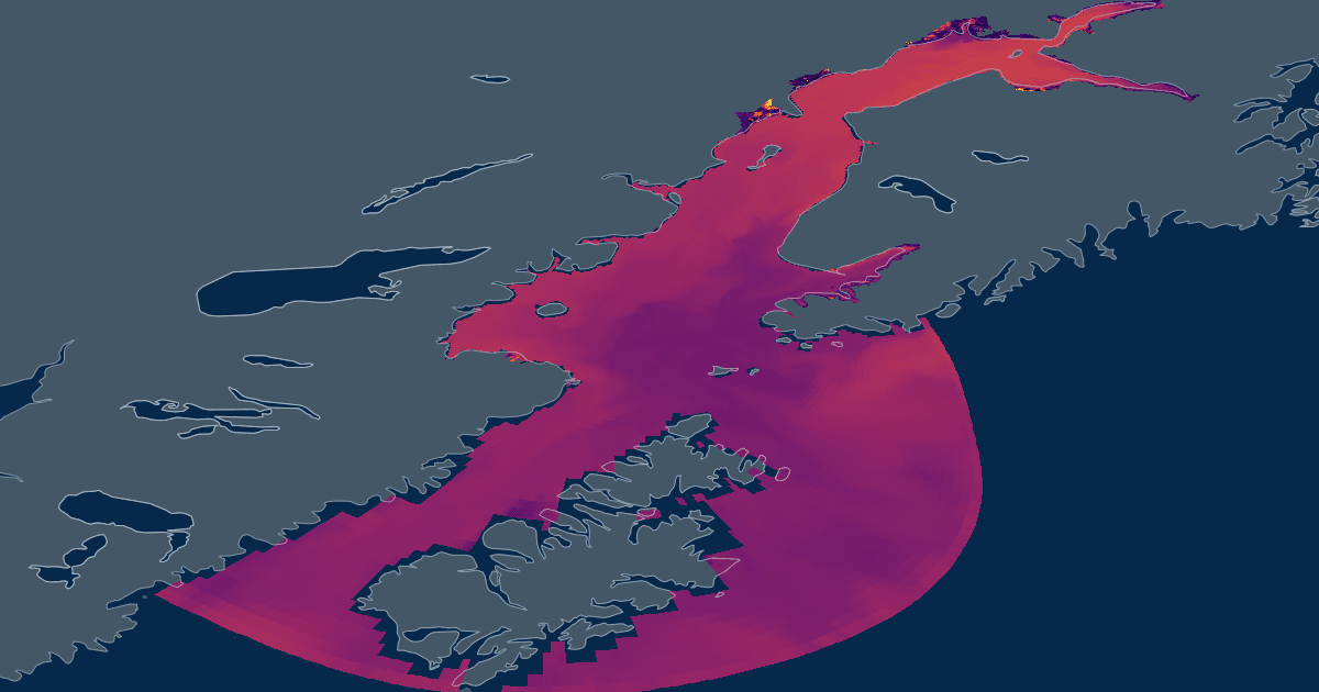
Coverage
Jul 28 – Oct 17
Cadence
6h
Forecast
48h
Variables
77
Grid
1,044×724
Vertical
30σ-levels
Coverageocean_time
span 2.7 months39 h ahead
now
Jul 28, 2026 13:00ZOct 17, 2026 18:00Z
Access
ZarrAvailable
Zarr store on S3 — open directly for best performance.
s3://noaa-nodd-kerchunk-pds/zarr3/ciofs.zarrWMSAvailable
Rendered map tiles for Leaflet, OpenLayers, QGIS.
https://cloud.data.ioos.us/xreds/datasets/ciofs_zarr3/wms/?service=WMS&request=GetCapabilitiesOpen in code
import xarray as xr

ds = xr.open_zarr(
    "s3://noaa-nodd-kerchunk-pds/zarr3/ciofs.zarr",
    zarr_format=3,
    consolidated=False,
    storage_options={"anon": True},
)
Cook Inlet OFS · Zarr v3, anonymous S3
import intake

cat = intake.open_catalog(
    "https://noaa-nodd-kerchunk-pds.s3.amazonaws.com/zarr3/intake.yml",
)
ds = cat["ciofs"].to_dask()
Cook Inlet OFS · resolved through the shared catalog
Dimensions13
tracer2s_w-1 → 0boundary4s_rho-1 → 0ocean_time1,707eta_rho1,044xi_rho724eta_psi1,043xi_psi723eta_v1,043xi_v724eta_u1,044xi_u723
Variables77
| name | standard name | units | dimensions |
|---|---|---|---|
| temp | sea_water_potential_temperature | Celsius | ocean_times_rhoeta_rhoxi_rho |
| salt | sea_water_practical_salinity | — | ocean_times_rhoeta_rhoxi_rho |
| u | sea_water_x_velocity | meter second-1 | ocean_times_rhoeta_uxi_u |
| v | sea_water_y_velocity | meter second-1 | ocean_times_rhoeta_vxi_v |
| w | upward_sea_water_velocity | meter second-1 | ocean_times_weta_rhoxi_rho |
| zeta | sea_surface_height_above_geopotential_datum | meter | ocean_timeeta_rhoxi_rho |
| Uwind | surface_x_wind | meter second-1 | ocean_timeeta_rhoxi_rho |
| Vwind | surface_y_wind | meter second-1 | ocean_timeeta_rhoxi_rho |
| Pair | surface_air_pressure | millibar | ocean_timeeta_rhoxi_rho |
| Akk_bak | not declared | meter2 second-1 | |
| Akt_bak | not declared | meter2 second-1 | tracer |
| Cs_w | not declared | — | s_w |
| Akv_bak | not declared | meter2 second-1 | |
| FSobc_in | not declared | second-1 | boundary |
| Cs_r | not declared | — | s_rho |
| FSobc_out | not declared | second-1 | boundary |
| Fbeta | not declared | — | |
| Lm3CLM | not declared | — | |
| Fgamma | not declared | — | |
| LnudgeM3CLM | not declared | — | |
| LnudgeM2CLM | not declared | — | |
| Lm2CLM | not declared | — | |
| Falpha | not declared | — | |
| LtracerCLM | not declared | — | tracer |
| LnudgeTCLM | not declared | — | tracer |
| Akp_bak | not declared | meter2 second-1 | |
| LuvSrc | not declared | — | |
| LsshCLM | not declared | — | |
| M2nudg | not declared | day-1 | |
| LwSrc | not declared | — | |
| M2obc_out | not declared | second-1 | boundary |
| M2obc_in | not declared | second-1 | boundary |
| M3obc_in | not declared | second-1 | boundary |
| Tcline | not declared | meter | |
| M3obc_out | not declared | second-1 | boundary |
| M3nudg | not declared | day-1 | |
| Tobc_out | not declared | second-1 | boundarytracer |
| Tobc_in | not declared | second-1 | boundarytracer |
| Tnudg | not declared | day-1 | tracer |
| Vstretching | not declared | — | |
| Zos | not declared | meter | |
| Znudg | not declared | day-1 | |
| angle | grid_angle_of_rotation_from_east_to_y | radians | eta_rhoxi_rho |
| Vtransform | not declared | — | |
| dt | not declared | second | |
| Zob | not declared | meter | |
| dtfast | not declared | second | |
| LtracerSrc | not declared | — | tracer |
| h | sea_floor_depth | meter | eta_rhoxi_rho |
| grid | not declared | — | |
| el | not declared | meter | |
| gamma2 | not declared | — | |
| hc | not declared | meter | |
| f | coriolis_parameter | second-1 | eta_rhoxi_rho |
| mask_psi | land_sea_mask_at_cell_corners | — | eta_psixi_psi |
| mask_v | land_sea_mask_at_cell_x_edges | — | eta_vxi_v |
| mask_u | land_sea_mask_at_cell_y_edges | — | eta_uxi_u |
| nSTA | not declared | — | |
| mask_rho | land_sea_mask_at_cell_center | — | eta_rhoxi_rho |
| nRST | not declared | — | |
| nHIS | not declared | — | |
| ndefHIS | not declared | — | |
| ndtfast | not declared | — | |
| ntimes | not declared | — | |
| pm | inverse_grid_x_spacing | meter-1 | eta_rhoxi_rho |
| rdrg2 | not declared | — | |
| rdrg | not declared | meter second-1 | |
| pn | inverse_grid_y_spacing | meter-1 | eta_rhoxi_rho |
| rho0 | not declared | kilogram meter-3 | |
| spherical | not declared | — | |
| theta_s | not declared | — | |
| wetdry_mask_psi | wet_dry_mask_at_cell_corners | — | ocean_timeeta_psixi_psi |
| theta_b | not declared | — | |
| wetdry_mask_rho | wet_dry_mask_at_cell_center | — | ocean_timeeta_rhoxi_rho |
| wetdry_mask_v | wet_dry_mask_at_cell_x_edges | — | ocean_timeeta_vxi_v |
| xl | not declared | meter | |
| wetdry_mask_u | wet_dry_mask_at_cell_y_edges | — | ocean_timeeta_uxi_u |
Attributes36
file
ciofs.t18z.20261015.fields.forecast_0041.nc
format
netCDF-4/HDF5 file
Conventions
CF-1.4, SGRID-0.3
type
ROMS/TOMS history file
title
ciofs forecast RUN in operational mode
var_info
varinfo.yaml
rst_file
ciofs.t18z.20261015.rst.forecast.nc
his_base
ciofs.t18z.20261015.fields.forecast
sta_file
ciofs.t18z.20261015.stations.forecast.nc
grd_file
ciofs.romsgrid.nc
ini_file
ciofs.t18z.20261015.rst.nowcast.nc
river_file
ciofs.t18z.20261015.river.nc
tide_file
ciofs.roms.tides.nc
frc_file_01
ciofs.t18z.20261015.met.forecast.nc
bry_file_01
ciofs.t18z.20261015.obc.nc
script_file
./ciofs_ROMS_forecast.in
spos_file
ciofs.stations.in
NLM_TADV
ADVECTION: HORIZONTAL VERTICAL
temp: HSIMT HSIMT
salt: HSIMT HSIMT
NLM_LBC
EDGE: WEST SOUTH EAST NORTH
zeta: Clo Cha Clo Clo
ubar: Clo Fla Clo Clo
vbar: Clo Fla Clo Clo
u: Clo Rad Clo Clo
v: Clo Rad Clo Clo
temp: Clo RadNud Clo Clo
salt: Clo RadNud Clo Clo
tke: Clo Gra Clo Clo
git_url
https://github.com/NOAA-CO-OPS/2024-NOS-Code-Package_v3.6.0
git_rev
c1e184cd03c2208a7b6924f2ef264d1c9feeb838
svn_url
https://www.myroms.org/svn/src/trunk
svn_rev
1209
code_dir
/lfs/h1/ops/test/packages/nosofs.v3.6.15/sorc/ROMS.fd
header_dir
/lfs/h1/ops/test/packages/nosofs.v3.6.15/include
header_file
ciofs.h
os
Linux
cpu
x86_64
compiler_system
ftn-intel
compiler_command
/opt/cray/pe/craype/2.7.17/bin/ftn
compiler_flags
-fp-model precise -ip -O3
tiling
024x034
history
ROMS/TOMS, Version 4.2, Thursday - October 15, 2026 - 7:01:51 PM
ana_file
ROMS/Functionals/ana_btflux.h, ROMS/Functionals/ana_rain.h, ROMS/Functionals/ana_stflux.h
CPP_options
mode, ADD_FSOBC, ADD_M2OBC, ANA_BSFLUX, ANA_BTFLUX, ANA_RAIN, ANA_SSFLUX, ASSUMED_SHAPE, ATM_PRESS, BOUNDARY_ALLREDUCE, BULK_FLUXES, COLLECT_ALLGATHER, CURVGRID, DJ_GRADPS, DOUBLE_PRECISION, HDF5, LIMIT_BSTRESS, LIMIT_STFLX_COOLING, KANTHA_CLAYSON, LONGWAVE_OUT, MASKING, MPI, MY25_MIXING, NONLINEAR, NONLIN_EOS, NO_LBC_ATT, N2S2_HORAVG, PERFECT_RESTART, POWER_LAW, PROFILE, K_GSCHEME, RADIATION_2D, REDUCE_ALLREDUCE, !RST_SINGLE, SALINITY, STEP2D_LF_AM3, SOLAR_SOURCE, SOLVE3D, SSH_TIDES, STATIONS, UV_ADV, UV_COR, UV_U3HADVECTION, UV_C4VADVECTION, UV_LOGDRAG, UV_TIDES, VAR_RHO_2D, WET_DRY
_xpublish_id
ciofs_zarr3
Source & extent
Model core
ROMS
Grid type
SGRID (curvilinear)
Region
Alaska
Spatial extent
−156.4853, 56.7005 → −148.9251, 61.5248
Store format
Zarr v3
Source store
s3://noaa-nodd-kerchunk-pds/zarr3/ciofs.zarr