San Francisco Bay OFS
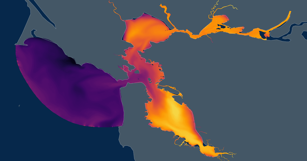
Last cycle 15 Oct 21:00 UTCsfbofsFine unstructured-mesh FVCOM forecast for San Francisco Bay and the Sacramento–San Joaquin Delta, capturing complex bathymetry and channels.
Produced by NOAA NOS CO-OPS
Coverage
Jul 28 – Oct 17
Cadence
6h
Forecast
48h
Variables
42
Grid
UGRID
Vertical
20σ-layers
Coveragetime
span 2.7 months42 h ahead
now
Jul 28, 2026 09:00ZOct 17, 2026 21:00Z
Access
ZarrAvailable
Zarr store on S3 — open directly for best performance.
s3://noaa-nodd-kerchunk-pds/zarr3/sfbofs.zarrWMSAvailable
Rendered map tiles for Leaflet, OpenLayers, QGIS.
https://cloud.data.ioos.us/xreds/datasets/sfbofs_zarr3/wms/?service=WMS&request=GetCapabilitiesOpen in code
import xarray as xr

ds = xr.open_zarr(
    "s3://noaa-nodd-kerchunk-pds/zarr3/sfbofs.zarr",
    zarr_format=3,
    consolidated=False,
    storage_options={"anon": True},
)
San Francisco Bay OFS · Zarr v3, anonymous S3
import intake

cat = intake.open_catalog(
    "https://noaa-nodd-kerchunk-pds.s3.amazonaws.com/zarr3/intake.yml",
)
ds = cat["sfbofs"].to_dask()
San Francisco Bay OFS · resolved through the shared catalog
Dimensions9
four4nele102,264node54,120time1,840three3maxelem9maxnode11siglay-1 → 0siglev-1 → 0
Variables42
| name | standard name | units | dimensions |
|---|---|---|---|
| temp | sea_water_temperature | degrees_C | timesiglaynode |
| salinity | sea_water_salinity | 1e-3 | timesiglaynode |
| u | eastward_sea_water_velocity | meters s-1 | timesiglaynele |
| v | Northward_sea_water_velocity | meters s-1 | timesiglaynele |
| zeta | sea_surface_height_above_geoid | meters | timenode |
| uwind_speed | eastward wind | meters s-1 | timenele |
| vwind_speed | northward wind | meters s-1 | timenele |
| atmos_press | not declared | pascals | timenode |
| a2u | not declared | — | fournele |
| art1 | not declared | — | node |
| a1u | not declared | — | fournele |
| awy | not declared | — | threenele |
| iint | not declared | — | time |
| h | sea_floor_depth_below_geoid | m | node |
| aw0 | not declared | — | threenele |
| awx | not declared | — | threenele |
| inundation_cells | not declared | — | timenele |
| latent_heat_flux | not declared | W m-2 | timenode |
| long_wave | not declared | W m-2 | timenode |
| art2 | not declared | — | node |
| Times | not declared | — | time |
| nbe | not declared | — | threenele |
| nbve | not declared | — | maxelemnode |
| nbsn | not declared | — | maxnodenode |
| net_heat_flux | not declared | W m-2 | timenode |
| nprocs | not declared | — | |
| nv | not declared | — | threenele |
| partition | not declared | — | nele |
| ntsn | not declared | — | node |
| ntve | not declared | — | node |
| short_wave | not declared | W m-2 | timenode |
| sensible_heat_flux | not declared | W m-2 | timenode |
| tauc | not declared | m^2 s^-2 | timenele |
| wet_cells_prev_ext | not declared | — | timenele |
| wet_nodes_prev_int | not declared | — | timenode |
| wet_cells | not declared | — | timenele |
| wet_cells_prev_int | not declared | — | timenele |
| xc | not declared | meters | nele |
| x | not declared | meters | node |
| y | not declared | meters | node |
| wet_nodes | not declared | — | timenode |
| yc | not declared | meters | nele |
Attributes15
title
SFBOFS
institution
School for Marine Science and Technology
source
FVCOM_4.4.7
history
model started at: 15/10/2026 21:31
references
http://fvcom.smast.umassd.edu, https://github.com/FVCOM-GitHub/FVCOM
Conventions
CF-1.0
CoordinateSystem
GeoReferenced
CoordinateProjection
init=nad83:402
Tidal_Forcing
Tidal Forcing Time Series Title: sfbofs lateral open boundary netCDF file
River_Forcing
THERE ARE 9 RIVERS IN THIS MODEL.
RIVER INFLOW IS ON THE nodes WHERE TEMPERATURE AND SALINITY ARE calculated IN THE MODEL.
THE FOLLOWING RIVER NAMES ARE USED:
11459150
11180700
11458000
11458000
11458000
11458000
11458000
11172175
11169025
GroundWater_Forcing
GROUND WATER FORCING IS OFF!
Surface_Heat_Forcing
FVCOM variable surface heat forcing file:
FILE NAME:sfbofs.t21z.20261015.hflux.nowcast.nc
SOURCE:FVCOM grid (unstructured) surface forcing
Unknown start date meta data format
Surface_Wind_Forcing
FVCOM variable surface Wind forcing:
FILE NAME:sfbofs.t21z.20261015.met.nowcast.nc
SOURCE:FVCOM grid (unstructured) surface forcing
Unknown start date meta data format
Surface_PrecipEvap_Forcing
SURFACE PRECIPITATION FORCING IS OFF
_xpublish_id
sfbofs_zarr3
Source & extent
Model core
FVCOM
Grid type
UGRID (unstructured)
Region
US West Coast
Spatial extent
−123.0228, 37.4275 → −121.6791, 38.2125
Store format
Zarr v3
Source store
s3://noaa-nodd-kerchunk-pds/zarr3/sfbofs.zarr