Salish Sea and Columbia River OFS
Last cycle 15 Oct 21:00 UTCsscofsFVCOM nowcast/forecast for Puget Sound, the Salish Sea and the Columbia River: water levels, currents, temperature and salinity out to 72 hours.
Produced by NOAA NOS CO-OPS
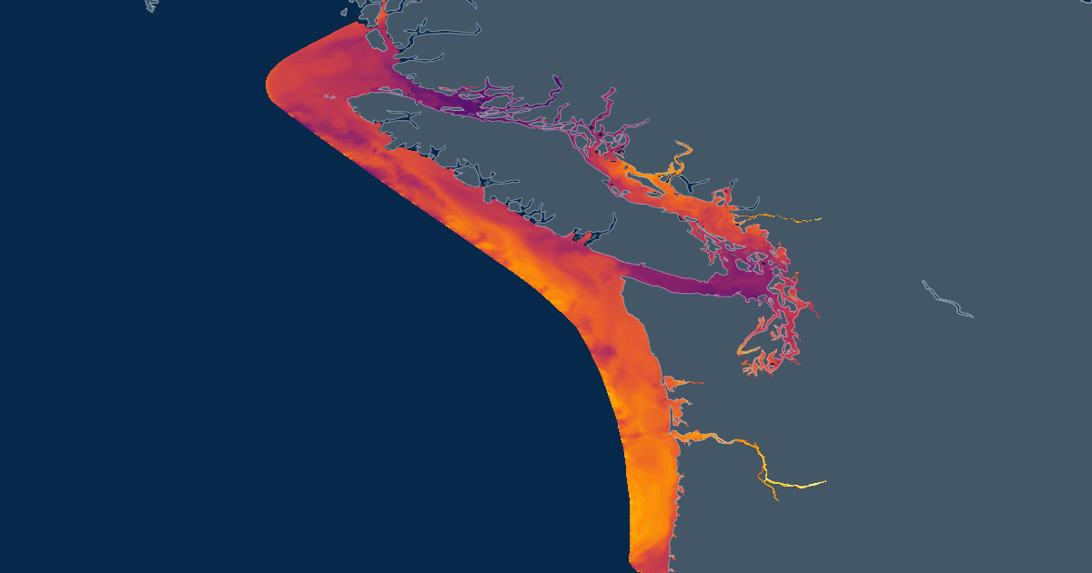
Coverage
Jul 28 – Oct 18
Cadence
6h
Forecast
72h
Variables
44
Grid
UGRID
Vertical
10σ-layers
Coveragetime
span 2.7 months2.8 days ahead
now
Jul 28, 2026 09:00ZOct 18, 2026 21:00Z
Access
ZarrAvailable
Zarr store on S3 — open directly for best performance.
s3://noaa-nodd-kerchunk-pds/zarr3/sscofs.zarrWMSAvailable
Rendered map tiles for Leaflet, OpenLayers, QGIS.
https://cloud.data.ioos.us/xreds/datasets/sscofs_zarr3/wms/?service=WMS&request=GetCapabilitiesOpen in code
import xarray as xr

ds = xr.open_zarr(
    "s3://noaa-nodd-kerchunk-pds/zarr3/sscofs.zarr",
    zarr_format=3,
    consolidated=False,
    storage_options={"anon": True},
)
Salish Sea and Columbia River OFS · Zarr v3, anonymous S3
import intake

cat = intake.open_catalog(
    "https://noaa-nodd-kerchunk-pds.s3.amazonaws.com/zarr3/intake.yml",
)
ds = cat["sscofs"].to_dask()
Salish Sea and Columbia River OFS · resolved through the shared catalog
Dimensions9
time1,835four4nele433,410three3node239,734maxnode11maxelem9siglev-1 → 0siglay-1 → 0
Variables44
| name | standard name | units | dimensions |
|---|---|---|---|
| temp | sea_water_temperature | degrees_C | timesiglaynode |
| salinity | sea_water_salinity | 1e-3 | timesiglaynode |
| u | eastward_sea_water_velocity | meters s-1 | timesiglaynele |
| v | Northward_sea_water_velocity | meters s-1 | timesiglaynele |
| ww | not declared | meters s-1 | timesiglaynele |
| zeta | sea_surface_height_above_geoid | meters | timenode |
| uwind_speed | eastward wind | meters s-1 | timenele |
| vwind_speed | northward wind | meters s-1 | timenele |
| atmos_press | not declared | pascals | timenode |
| Times | not declared | — | time |
| a1u | not declared | — | fournele |
| awy | not declared | — | threenele |
| a2u | not declared | — | fournele |
| awx | not declared | — | threenele |
| art1 | not declared | — | node |
| aw0 | not declared | — | threenele |
| iint | not declared | — | time |
| inundation_cells | not declared | — | timenele |
| art2 | not declared | — | node |
| h | sea_floor_depth_below_geoid | m | node |
| latent_heat_flux | not declared | W m-2 | timenode |
| long_wave | not declared | W m-2 | timenode |
| nbsn | not declared | — | maxnodenode |
| nbe | not declared | — | threenele |
| nbve | not declared | — | maxelemnode |
| nprocs | not declared | — | |
| ntsn | not declared | — | node |
| net_heat_flux | not declared | W m-2 | timenode |
| nv | not declared | — | threenele |
| omega | not declared | s-1 | timesiglevnode |
| ntve | not declared | — | node |
| sensible_heat_flux | not declared | W m-2 | timenode |
| short_wave | not declared | W m-2 | timenode |
| partition | not declared | — | nele |
| tauc | not declared | m^2 s^-2 | timenele |
| wet_cells | not declared | — | timenele |
| wet_cells_prev_int | not declared | — | timenele |
| wet_cells_prev_ext | not declared | — | timenele |
| wet_nodes | not declared | — | timenode |
| x | not declared | meters | node |
| wet_nodes_prev_int | not declared | — | timenode |
| y | not declared | meters | node |
| xc | not declared | meters | nele |
| yc | not declared | meters | nele |
Attributes15
title
SSCOFS
institution
School for Marine Science and Technology
source
FVCOM_4.4.7
history
model started at: 15/10/2026 22:08
references
http://fvcom.smast.umassd.edu, https://github.com/FVCOM-GitHub/FVCOM
Conventions
CF-1.0
CoordinateSystem
GeoReferenced
CoordinateProjection
proj=utm +ellps=WGS84 +zone=10
Tidal_Forcing
Tidal Forcing Time Series Title: sscofs lateral open boundary netCDF file
River_Forcing
THERE ARE 38 RIVERS IN THIS MODEL.
RIVER INFLOW IS ON THE nodes WHERE TEMPERATURE AND SALINITY ARE specified IN THE MODEL.
THE FOLLOWING RIVER NAMES ARE USED:
14144700
14144700
08MF005
08MF005
12200500
12200500
12167000
12167000
12150800
12150800
14211720
14211720
12213100
12213100
12201500
12201500
12113000
12113000
12089500
12089500
12101500
12101500
12061500
12061500
12080010
12080010
12031000
12031000
12045500
12045500
12048000
12048000
12054000
12054000
14220500
14220500
14243000
14243000
GroundWater_Forcing
GROUND WATER FORCING IS OFF!
Surface_Heat_Forcing
FVCOM variable surface heat forcing file:
FILE NAME:sscofs.t21z.20261015.hflux.forecast.nc
SOURCE:FVCOM grid (unstructured) surface forcing
Unknown start date meta data format
Surface_Wind_Forcing
FVCOM variable surface Wind forcing:
FILE NAME:sscofs.t21z.20261015.met.forecast.nc
SOURCE:FVCOM grid (unstructured) surface forcing
Unknown start date meta data format
Surface_PrecipEvap_Forcing
SURFACE PRECIPITATION FORCING IS OFF
_xpublish_id
sscofs_zarr3
Source & extent
Model core
FVCOM
Grid type
UGRID (unstructured)
Region
US West Coast
Spatial extent
−129.5065, 44.3926 → −121.959, 52.1123
Store format
Zarr v3
Source store
s3://noaa-nodd-kerchunk-pds/zarr3/sscofs.zarr